2017. január 17., kedd

DGD Underground 2 - A Bogos-barlang

DGD 2

Ebben a posztban a Bogos-barlang 2016-os kutatását mutatjuk be. A barlangot még 2010-ben találták meg, de a kutatása 2012-ben félbeszakadt, mert a felfedező csapat, az Adrenalin tagjai már nem vettek részt az expedícióban. Konkrét terv nélkül lévén, kapva kaptunk az ígéretes lehetőségen, és (egy korábbi Adrenalinos jelenjétében) magunk kezdtük újra a feltárást Sárközy Ádám vezetésével.


Fotó:
A jó szándék kövei/The rocky road to...
(Fotó: Lukács Kata)

This post is about the continued 2016 exploration of cave Bogos. The cave has been discovered in 2010, but its exploration has come to a standstill in 2012 because the original explorer team, the Adrenalin Speleology Team's members didn't take part in the expeditions recently. Our team, lacking a sound plan for the expedition, was more than glad to hear about this opportunity. So with the help of a Adrenalin team member, under the leadership of Ádám Sárközy we restarted the explorations. 

A környék/The neighborhood
(Fotó: Sárközy Ádám)

Már feljutni is érdekes volt, ugyanis a Njegusi polje szintjétől egy sziklás kecskehágó utacskán kellett felmenni az autókkal, amik minket, s a felszereléseinket is szállították. (Elkerülendő a puhány jelzőt persze akadt olyan alkalom is, amikor ösvényt nem ismerve, tökön-paszulyon keresztül vágtunk át a karrmezős hegyoldalon, de ez már csak a sportérték miatt volt fontos.)

Fotó:
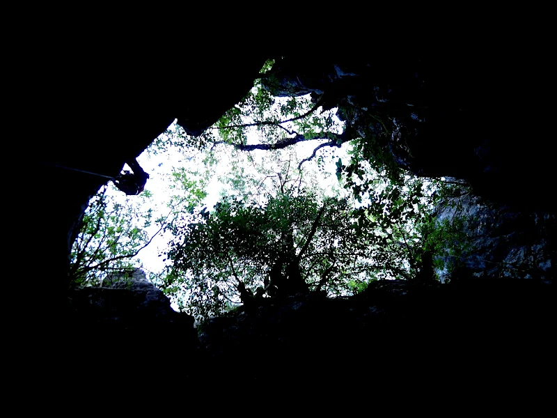
A bejárat lentről/The entrance from below
(Fotó: Lukács Kata)

Even the ascent to the cave was an interesting experience. The cars transporting our equipment had to ascend from the level of the Njegusi Polje on a road that civilised westerners may call too hazardous even for a goat's path. (Although to avoid the epitheton ornans of couch potatoes we naturally have crossed down to the village on the karst, but that was only for the sports performance.)

A lelkes csapat/The eager crew
(Fotó: Marosy Bence)

A barlang 1074 méter magasan nyílik, Njegusi falutól észak-északkeletre. Egy régi, világháborús hadiúttól pár méterre található a bejárata, ami egy 25 méter mély meander, s egy meredek, omladékos álfenékben végződik. Az álfenék nem túl szakszerű fordításban annyit tesz, hogy valamikor beszakadt a meanderbe egy kő, aztán több kicsi rá (itt persze több tíz köbméteres tételekben kell gondolkodni), amik egy „dugót” alakítottak ki alkalmanként össze is cementálódtak, így járhatóak, de nem szálkő, nem a barlang igazi alja.


Fotó:
Akna, a kötélpályával/Shaft with a ropetrack
(Fotó Lukács Kata)

The cave opens at the altitude of 1074 above sea level, Northeast of the village Njegusi. The entrance is near an old WW2 military road, that is a 25 m deep meander, that ends in a steep debris pseudo-bottom. The pseudo-bottom roughly translated means that it is not the real bottom of the cave, but rather that some time ago a rock got stuck in the meander, and debris fell on top of it, creating a cementated stopper that we are able to walk on. 


Egy kedves helyi lakos/A friendly local
(Fotó: Sárközy Ádám)


Ez az omladék, szerencsére csak képletes fejfájást okozott nekünk meredekségével (csak kötélbiztosítással lehetett rajta közlekedni), de benne volt a potenciál, hogy komoly sérülés is előfordulhasson: egy óvatlanul megindított kő könnyen elláthatta volna alattunk kepesztő társaink baját, hiszen 10-12 emeletnyi zuhanás segítette volna ebben az ádáz követ. 

Although this debris only caused theoretical headache with its steepness (one could only descend on it with a ropetrack) it had the potential to cause serious injuries. A carelessly kicked pebble could end our mates' lives rightly, while they were struggling on the ropes below us. After all the vicious stone would have fallen from the height of a 10-12 story building.  


Kilátás a csontvázaktól/View from the skeletons' place
(Fotó: Marosy Bence)


Az omladékon leóvakodva tehát,elkerülve, hogy az alattunk levők fejére rúgjunk egy túlzottan halálos méretű követ, pár átszerelés után egy körülbelül 30 méteres aknába érkezünk, az érzékeltetés kedvéért, ez pont olyan magasság, mintha a 10 emeleten nem várnád meg a liftet, hanem  szépen kötélen ereszkednél le a -2. szintig. Ennek az alján ismét egy álfenék, ezúttal pár szerencsétlenül járt állat csontvázával dekorálva, ám immár kicsit biztonságosabb lejtszöggel. Ezen újabb álfenék után egy kb 4 méteres lemászás jön, aminek a végén térben kb a korábbi érkezési pontunk alá toppanunk be.

So after creeping down the debris without kicking any too lethal rocks, after surpassing some dowels we reach an approximately 30 m deep shaft. For comparison, you wold have to make tha same descent if you wouldn't wait for the elevator ont the top of a 10 story building, and would go straight down to the -2nd level. At the bottom of this descent there is also a debris bottom, decorated with the skeletons of some unlucky animals. This debris had a friendlier sloping angle, After the debris there is a cca. 4 m downward climbing, at the end of the climbing we arrive just below our ropes below the debris.

Itt egy szűk kis folyosóba érkezünk, a meander része ez is. Az alja szintén álfenék, tisztán látszik rajta, hogy nagyobb esőzések idején innen ömlik lefelé a víz. A folyosó magasabb részein itt-ott cseppkőkéreg formálódott. Egyébként ez volt az egyik kedvenc ücsörgős helyünk a térképezés folyamán (se), mert a barlang csodálatos mikroklímájának köszönhetően állandó 2°C-os vízpermetes huzat biztosította, hogy ne hevüljünk túl az izgalomtól.

Fotó:
Egy meander/A meander
(Fotó: Lukács Kata)

Here we arrive at a narrow corridor, it is also the part of the meander. The bottom is also debris here, with signs indicating that during heavy rainfalls water floods through here. On the higher parts of the corridor there is a calcite crust developing. It was one of our favourite places in the cave (not) because of the constant wet 2°C wind , that prevented us from overheating from excitement.

A folyosóról egy ablakon kimászva egy újabb akna tárul elénk a falon kalcitos cseppkőkéreggel, az alján egy gyönyörű barlangi tóval. Az akna a Pelés-akna nevet kapta a keresztségben, mert amikor az azt megtaláló Adrenalinosok először beszerelték, az akna falán, közel 90 méter mélységben a felszíntől, egy pele mászkált a falon, biztosítás és sisak nélkül a teljes sötétben, olyan természetességgel, mintha mi épp leugranánk a közértbe tejért. A csapat legendának hitte az elnevezést, de több észlelés után kiderült, hogy tény: a pelék valóban lejutnak odáig, és valahogy túl is élik, mert nem sok pele-tetemmel találkoztunk a merüléseink során.

Fotó:
Egy másik helyi erő/Another friendly local
(Fotó: Lukács Kata)

By climbing through a natural window from the corridor we spot a shaft with stalactite crust on the walls, and a beautiful lake at the bottom. The shaft earned the name Dormouse shaft, because when the first explorers of the cave entered here, there was a dormouse climbing on the walls carelessly without any helmets or lighting 90 metres below the surface, so casually just as you would have a sunday stroll in the park.Our team thought it was just a legend, but after numerous sightings it is considered a fact, a number of these creatures get down there, and manage to survive, because we haven't encountered any corpses of them on our way. 


A Pelés akna felülről/The Dormouse shaft from above
(Fotó: Sárközy Ádám)


Az aknából a tó fölött pár méterrel tudunk kimászni egy meanderbe, onnan kis lefelé kapaszkodással egy terembe, amit narancssárga kalcitkéreg borított, mivel nem volt információnk, hogy ennek a helynek neve lenne, ezért csapatunk egyik szakosztályáról az uránbányász nevet kapta a keresztségben. Ebből a teremből egy szűk ferde járat, épp egy koporsó méretű vezet a következő aknába. Pont elég szűk ahhoz, hogy a stopcsigán ereszkedve kényelmetlen legyen, mert a kéz épp csak kezelni tudja az eszközt, a felső tested szépen beszorulva gebődik, míg az alfeled már egy több tíz méteres aknában harangozik.


A tó fölött/Above the lake
(Fotó: Sárközy Ádám)


A few metres above the lake we can climb through into a meander again, and from there a little descent to a cavity, coated with orange crystalline crust. Because we had no information that this place had a name, we named it Uranium miners' hall, after a section of our club. From this cavity there is a sloped little hole, the size fo a coffin, that leads you to the next large shaft. It is just tight enough that it is uncomfortable to use your clinbing equipment. Your upper parts are nicely stuck in this part, while your legs are swinging around in the top of the 40 m deep shaft. 


Valahol közel az aljához/Somewhere near the bottom
(Fotó: Sárközy Ádám)


Az akna kb 40m mély, az aljában ennek is egy tavacska vár, a fala végig gyönyörű narancsszínű cseppkőkéreggel borított. Ennek a végén egy kis párkányra tudtunk kimászni, s részünkről, a térképezős csapat részéről eddig jutott a lézeres távmérővel és irányszögmérővel történő kalandozás, a további szorgos rajzolás a 2017-es esztendő feladata lesz.

This shaft also has a lake at its bottom, and it is also coated with orange calcite, although the crystalline formations are more spectacular. At the bottom we could climb up to a small ledge, and that was the end of the carthographers' team's route, with all our laser telemeters, and other fancy stuff. The drawing of the map from here on, is the task of year 2017. .


Fotó:
Kis holdbéli táj/A little moonscape
(Fotó Lukács Kata)


A többiek, a beszerelő csapat tagjai lejutottak a szintes ágba, ahol több irányban is elindultak. Az adrenalinosok annó bivakot létesítettek itt, s e táborból kiindulva fedezték fel a barlang mélyen fekvő részeit. Az idei év feladata lesz az ígéretes részek felderítése a be nem járt részek bejárása, és a várható további lejutás megtalálása.

The members of the vanguard team reached the horizontal part of the cave, and explored in numerous directions. The members of the Adrenalin team built a camp here, that served as an underground base for further explorations and discoveries. This year's task is to explore the currently unknown parts, and to find a possible downward path again. 
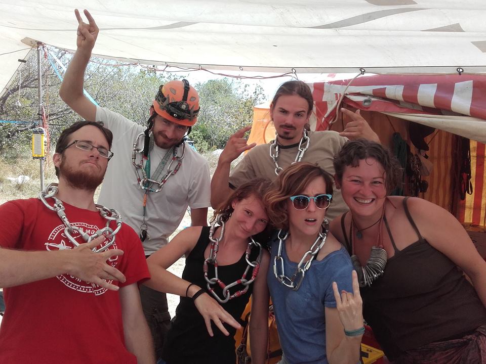


A csapat egy része/A part of the crew
(Fotó: Marosy Bence)


Fotó:
És ki tudja, mit rejt még/Who knows what may come next
(Fotó: Lukács Kata)

2016. szeptember 14., szerda

DGD Underground 1 - Expedíció Montenegróban


A most következő két poszttal megmutatjuk nektek, hogy nem csak a magasság, a mélység sem tántoríthat el minket egy jó kis kalandtól. Lehetőségünk nyílott ugyanis részt venni a Magyar Karszt és Barlangkutató Társaság montenegrói barlangi expedícióján. Ez az expedíció évente kerül megrendezésre, augusztus első heteiben, számos magyarországi és külföldi csapat részvételével, célja a környék barlangjainak felkutatása, bejárása, és dokumentálása.

With our next two posts we'll try to show you that neither height, nor depth can scare us from having some fun! We had the opportunity to join the Hungarian Speleological Society's cave expedition in Montenegro. This expedition is organized annually, takes place in the first two weeks of August since 2003. Numerous Hungarian and international teams participate every year. The aim of the expedition is to discover, explore and document the caves ot the area. 

Ereszkedés - The descent
(Fotó: Lukács Kata)


A tábor Njegusi falu mellett bújt meg, egy pár töbör között, a környéken ritka kincsnek számító apró sík részen. A Njegusi-polje a Kotori-öböltől kb 10 km-re keletre fekszik, a Dinári-hegység karsztosodott mészkőcsúcsai közt, 850-1400 méteres magasságban.

The Camp was located near Njegusi, on a treasured small flatland among the slopes. The Njegusi polje lies 10 kms East of the bay of Kotor, nested at the height of 850-1400 metres among the most karstified ridges of the Dinarides.

A környék - The "neighborhood"
(Fotó - Sárközy Ádám)

 A tábor - The camp
(Fotó - Sági Bence)

Itt található a legmélyebb, magyarok által feltárt barlang, a 715 méter mély, és 7,5 km hosszú Kétlyukú-Jeges barlangrendszer.  A, magashegyi típusú barlangokban, ellentétben a budai termálvizes barlangjaink labirintusszerű járataival, szűk meanderező részek váltakoznak több tíz méteres aknákkal.Tavaly került felfedezésre a kb 400 méter mélységben nyíló, 30 m átmérőjű, 312 m mély Hubertus akna. Az érzékeltetés kedvéért, kb olyan mély, hogy az Eiffel-torony alig 10 méter híján eltűnne benne. Mindezt olyan mélyen, hogy ennek az egésznek a tetejére még mindig elférne a chicagoi Sears-torony, és épp csak karcolná a felszínt.

The deepest cave discovered and explored by Hungarians is located here. It is the Kétlyukú-Jeges cave system, (Ledena pećina) which is 715 metres deep and 7,5 kms long. In the alpine cavetypes, as opposed to the labyrinth-like thermal caves of Buda, narrow meandering parts alternate with shafts measuring tens of metres. The Hubertus shaft has been discovered last year. Opening at the depth of 400 metres from the surface, it is 300 metres deep, and 30 metres across. Just for comparison if one would stuff the Eiffel tower in this shaft, only 10 metres would be visible from the top. At a depth that the Sears tower of Chicago would still fit atop it, and would barely scratch the surface. 


 Hubertus-akna - Hubertus shaft
(Fotó - Berentés Ágnes)


Az expedíció résztvevői 4-6 fős csoportokra osztódtak, és különböző feladatokat láttak el egy-egy barlangnál. 

The crew of the expedition were divided into groups of 4-6 and given their respective tasks in different caves.

A csapat - The crew
(Fotó - Sárközy Ádám)


Voltak csapatok, akik a felszínen kerestek új barlangnyílásokat, ami a karrmezőn nem is olyan ritkaság. Ha megvolt az ígéretes barlangkezdemény, jött egy beszerlő csapat, akiknek az volt a feladata, hogy kiépítse a barlang bejárásához elengedhetetlen kötélpályát, és egyben pionírként fel is derítse azt, amíg lehetősége van.

Some teams looked for new caves on the surface, and there were quite a few around on the karst fields. If they found something promising enough, the  ropetrack team comes in, and sets up the ropes necessary for exploring the cave, and start pioneering the exploration to so long as it is possible.

 Piros, leereszkedik a kéményen, és mégsem Mikulás - Red, goes down shafts, yet it's not Santa
(Fotó - Sárközy Ádám)


Utánuk jöhetnek a fotós csapat tagjai, akik fényképanyaggal járulnak hozzá a barlang dokumentációjához. (S akiknek a végén a leghálásabb mindenki, mert tőlük lesz kép a blogra)
Végül a sort a térképezős csapatok zárják, akik hosszasan ücsörögve rajzolják fel a barlang hossz és keresztmetszetét, hogy a táborban pihengető nagyöregek is képet kaphassanak a földmély dolgairól.

After the first teams the photographers' team is launched. They are the ones who supplement the photographic documentation of the caves. (And to whom we are most grateful after all, because they present us with pictures for the blog)
The last of the teams are the cartographers, who sit around endlessly while they draw the cross- and longitudinal-sections of the cave, so that the seasoned old cavers back at the camp, who are not active anymore can get a picture about what lies beneath. 


 (Fotó - Lukács Kata)
Eközben a felszínen bevetésre készen vár az ügyelet, aki szükség esetén elindítja a Barlangi Mentőszolgálat helyszínen lévő tagjait, valamint külön említést érdemelnek a barlangba nem járó, de kulcsfontosságú családtagok, tapasztalt öregek, és egyéb tábori népek, akik napi szinten egyben tartják a tábort.

Meanwhile the cave rescue team was steady in the camp just in case. And last but not least we have to mention the people who, although did not descend with us, but who kept the camp together: family members and the old cavers.

A következő posztban bemutatjuk nektek a Bogos-barlang feltárását. Olyan helyekről láthattok képeket, ahol kevesebben jártak, mint a világűrben! Előttünk csak az Adrenalin Barlangkutató Egyesület tagjai jártak ott, akik a barlang megtalálói, de összességében így sem volt lent több, mint 15 ember a 7 milliárdból!

In the next post we'll introduce you the exploration of the Bogos-cave. You'll be able to see pictures from places where fewer people have set foot than in outer space! Only the discoverers of the cave, the Adrenalin Speleological Society members preceded us, but the total count still does not exceed 15, out of the 7 billion!


Addig is
Until then

2016. augusztus 3., szerda

Éves almandinszüret/ Yearly Almandine harvest


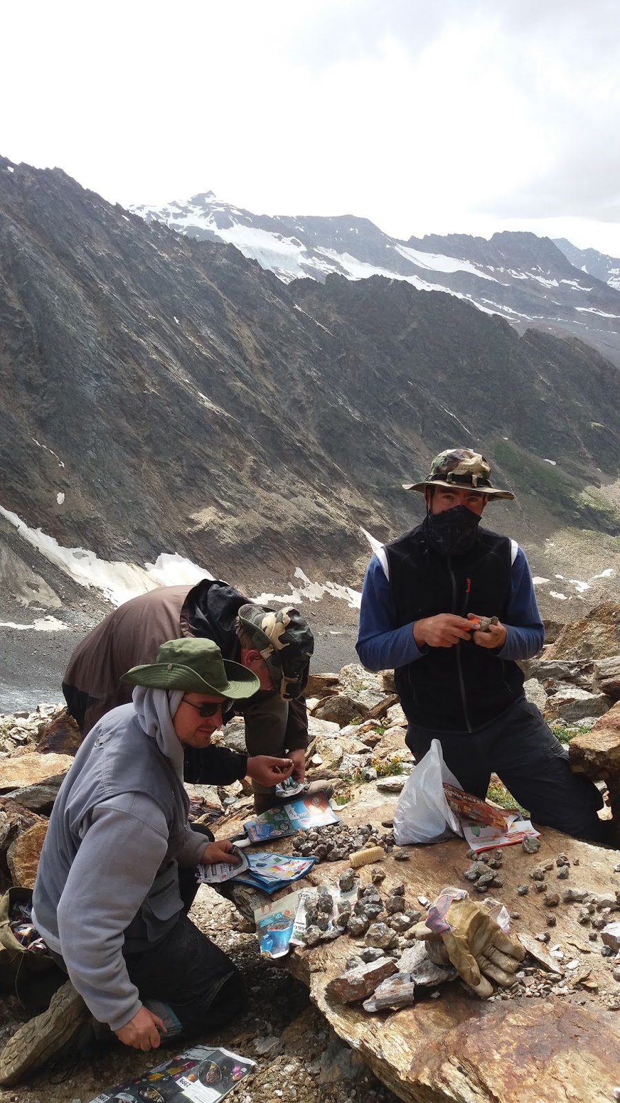
Ausztriai utunk második felében visszatértünk kedvenc almandinos lelőhelyünkhöz, Obergurglhoz, hogy a felderítés mellett akadjon egy biztos pont is túránk során.

In the second part of our Austrian trip we returned to our favorite almandine locality, Obergurgl. That’s because we wanted some infallible find in additional to the exploration.


Az időjárás itt sem volt a legjobb, azonban kis szerencsével és az eredeti tervek teljes felborításával, az ott töltött három teljes napból az első nap sikerült még feljutnunk úgy, hogy csak egyszer áztunk el a nap végén. Az időjárásjelentés természetesen jelezte, hogy a délutáni óráktól eső várható, de ez a jelzés egészen ottartózkodásunk végéig élt, így úgy döntöttünk, hogy mikor is, ha most nem.

The weather wasn’t that good in this place also, but with some luck and reorganization of our original plans on the first day of the three optional days we had chance to go up to the wall. So that we got soaked only once.


Hajnali órákban indultunk kisebb nagyobb másnappal házigazdánk vendégszeretete jóvoltából, elvégre mi más kell egy jó hegymászáshoz mint egy kiadós ünneplés előző este. Természetesen akkor egyikünk sem panaszkodott. ;) Az út teljesen ismert volt és minden terv szerint haladt egészen addig amíg el nem értük a gleccser tövét. Ott volt az a pont amikor rá kellett jönnünk, hogy bizony a kőomlás, ahol tavaly közlekedtünk totálisan át volt rendezve, gondolom én a hó, lavinák, olvadás és más pusztító erők által. Miután többszöri nekifutásra megtaláltuk a megfelelő felfelé vezető útvonalat, már csak a laza omladék okozott kellemetlenséget, talán a késői olvadásnak köszönhetően.

We started our journey at early morning, with a little hangover, because of the hospitality of our host. Yeah, normally that’s what we need for a good mountain hiking. Naturally no one complained the night before. ;) The path was known by us and everything progressed according to plan until we reached the first stone rift. We noted in that point that the rift changes year after year because of the snow, avalanche, water and other unknown destructive powers. After several attempts we found the best way up there, we had only problem with the loose stones. Maybe it’s because of the late melting.


Végeredményképp felértünk időre, majdnem ahogy terveztük, s sikeresen begyűjtöttünk egy adag pucolnivaló vagy épp kimálott almandint. Kicsit elszaladt az idő, így idén ugyan nem az éjszaka elől, hanem az esőfelhők elől menekültünk le a biztonságot adó völgybe, ahonnan annak ellenére, hogy rongyá áztunk, elégedetten gyalogoltunk vissza a faluba.

So we arrived in time to the locality almost as planned and we collected a bunch of almandines successfully. We started back a bit late and we fled from the rain instead of the night this year. In the valley we soaked well, but we returned to the village with some satisfaction.


A további napokban, az időjárásra való tekintettel a további kirándulások helyett a Gránátos Jeti hagyatékát néztük meg Söldenben. Kicsit csalódással tölt el, hogy az ott kiállított darabok egy részét megmunkálták, azonban még így is kellő inspirációt ad nekünk, hogy újra felmenjünk. Megtudtuk a múzeumban, hogy azok a gránátos lelőhelyek elérhetetlenek átlag turisták számára, de mi ezt nem tudtuk, ezért az egyikre már eljutottunk. Kétszer.

In the next few days we visited the Museum of Granaten in Sölden. It was a good idea instead of hiking because of the weather. I was a little bit disappointed, because a part of the pieces was processed (not just prepared), but I think the whole museum was a good inspiration for a next round. In the museum we learned that the almandine localities of the Granaten Yeti are unreachable for simple hikers, but we didn’t know that. So we did it. Twice.


2016. július 27., szerda

Zillertali kalandozások / Journey in Zillertal


Egy kiadósabb szünet után újra itt vagyunk. A tavalyi év nem szegte kedvünket, hogy újra kiugorjunk Ausztriába. Az első állomásunk Zillertal volt. 

After a long break we are here again. Last year was good enough that we think we should have repeated the Austrian tour. But now our first destination was Zillertal. 


Szombat kora hajnalban indultunk, ugyanis a megközelítőleg 8 órás kocsiút után még várt ránk egy kisebb séta fel a szállásig. Normál esetben a cél a csodálatos Berliner Hütte lett volna, azonban a csapat felszereltsége, ideje és anyagi megfontolások is indokolták, hogy az első éjszakánkat mintegy 300 m szinttel és majd egy órával közelebbi Alpenrosenhüttében töltsük el. Így csak ezután költöztünk fel eredeti célunkhoz 

We started at Saturday morning, because we needed to go up to our lodging after a 8 hours long travel by car. Normally our destination would have been the Berliner Hütte, but it was well founded to sleep in the Alpenrosenhütte first night. It's ca. 300 m below  and an hour closer to the valley entrance. So we arrived only at Sunday to our final destination. 


Tapasztalat, ha az ember sok cuccal érkezik, már pedig az ember aki ásványozni megy az sok cuccal érkezik, igen nagy szívás felbaktatni. Átlagosan 20-30 kilógrammos zsákokkal 8 kilómétert és mintegy 800 méter szintet másztunk, és ez noha sportteljesítménynek nem nagy, a korábban említett kisebb sétának már meglepő volt. 

Our experience, that someone who came for minerals are arrive here with many stuff, (normally people comes here with many stuff,) to get up there is simply sucks. We brought ca. 20-30 kg packages trough 8 km to an 800m higher level. It’s not a big sport performance, but for a small walk it was pretty surprising.


Alapvetően számos lelőhely található a környéken, amelyet például a mindat.org oldalról is meg lehetett nézegetni. A gyakorlat azonban itt sem találkozott a tervekkel. Vasárnapi nap során a kinézett legközelebbi lelőhely legalja is havas volt, és még grátisz az idő is elromlott, így jobb híján csak sétáltunk egyet majd megszárítkoztunk. 

Basically there are many mineral locality in this region, about those you can find information for example on the mindat.org, but the practice never meets with the plans. At Sunday was snow all around the locality, and the top of that there were bad weather, so we had a short trip and after we dried our clothes. 


Érdemben a második gyűjtésre szánt napot is kirándulással töltöttük, így jutottunk fel a Berlinerspitze egy előhegyére, ami az odavezető útnak köszönhetően némi büszkeséggel töltött el. Jutalmul a számos kifosztott üreg mellett sikerült találni egy pici ám annál nagyobb örömet okozó érintetlen sarkot is, amelyből ha nem is a legszebb, de saját gyűjtésű alpesi kvarcok kerültek elő. Másik előnye ennek a túrának az volt, hogy legalább a diopszidos lelőhelyről leolvadt a takaró. 


Mostly we used our second collecting day for wandering as well, so we climbed on the top of the foothill of the Berlinerspitze, which was a kind of trophy for us. As reward we found next to some looted crystal pockets a small but joyful pocket part. Out of that we get some medium quality, but self-collected quartz pieces from the Alpen. The other benefit of this trip was that meantime the snow melted away from the Diopside Rift. 


Fent. / Up.

Persze csak óvatosan, nehogy értünk is jönnie kelljen... /
Of course be careful, lest it also have to come for us ...


Ezen felbuzdulva indultunk neki újra a nagy küldetésnek, amely végül, ha nem is túl nagy sikerrel, de sportértékkel mindenképp rendelkezett. Gyakorlatilag több idő szükséges egy számunkra teljesen új ásvány teljesen új környezetben való gyűjtéséhez. Ez pedig a szeszélyes nyár okán sajnos nem adatott meg. 

Encouraged by this we started our trip to the rift again. The result wasn’t that good, but it was a new challenge for us. I think more time is needed to find a new type of mineral in a new environment. Unfortunately it was not possible because of the changeable weather.


És végül lássunk pár darabot a környékről/ And let's see a few pieces from the region: