2017. április 6., csütörtök

Barangolás Selmecbányán / Exploring around Selmecbánya

Március végén tettünk egy két napos kiruccanást Selmecbányára illetve Libetbányára. A környék híres a bányászati történelméről, illetve ásványkincseiről. Ezen felbuzdulva megkerestük néhány régi bánya meddőhányóját.
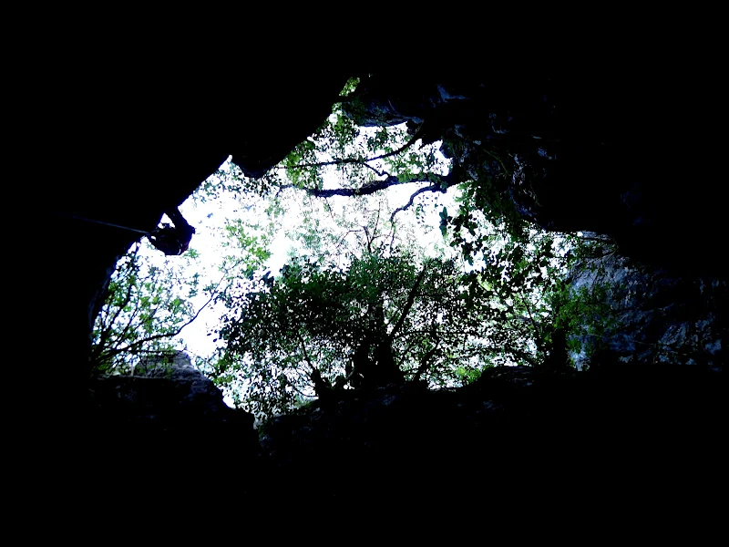
Szombat reggel korán indultunk és miután elfoglaltuk a szállást, nekivágtunk a Teréz-táró felkutatásának. Viszonylag könnyen odataláltunk, hála a segítségnek amit kaptunk. A közúttól nem is kell sokat gyalogolni a lelőhelyig, mely önmagában is elég feltűnő.

We took a two days lond trip around Selmecbánya at the end of March . The area is famous about mining history and minerals. Encouraged by this we look after some old mine deposits.
We went early on Saturday morning and after the accomodation occupation we started tracing the tunnel Teresa. It was found relatively easy thanks for the great help what we got.The locality was quite close to the road and itself was quite striking.


In situ találtunk néhány szép darabot. A követ nehéz volt törni, rendkívül kemény! Erről a véső is tanúskodik....

In situ we found some good pieces. The stone was hard to break, it was extremely hard. The chisel is the evidence...


Ezután még ellátogattunk a Glanzenberg nevű lelőhelyre, ahol inkább a fotózás volt a középpontban. Túl sok mindent nem sikerült találni, de a helyet önmagáért is érdemes meglátogatni. A telérek kibányászása felszínen történt, ami látványos nyomokat hagyott maga után. Továbbá a kilátás is csodás a városra.

After that, we were visited Glanzenberg locality, where the photography was in focus than minerals. We did not find too much piecees. The place itself is worth a visit. The mining of the ore loads were happened from surface mines which resulted in spectacular signs. And also the view is beautiful to the city.


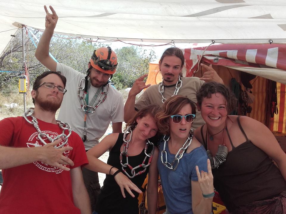
Esti program, egy kis kulturálódás és városnézés, és persze a helyi italok és ételek megkóstolása.

Evening program, a little culture and city trip and of course tasting of the local drinks and food.


Vasárnap Libetbányára látogattunk, ami a mikrós ásványok paradicsoma. A táj itt is festői és rengeteg bányatárna található, egészen az 1800-as évekből. Ezek anyagát érdemes nézegetni.

We visited Libetbánya at Sunday which is paradise of  micrometer minerals. The picturesque scenery here and we can find a lot of mines too, even from 1800s. These materials should looking at.


És végül lássunk pár darabot a környékről/ And let's see a few pieces from the region:

Selmecbánya: Ametiszt, kvarc / Amethyst, quartz


Libetbánya:
 Pseudomalahit / Pseudomalachite
  Pseudomalahit / Pseudomalachite
 Kalkopirit, malahit / Kalkopyrithe, malachite
 Malahit / Malachite
Libetenit / Libethenite


2017. január 17., kedd

DGD Underground 2 - A Bogos-barlang

DGD 2

Ebben a posztban a Bogos-barlang 2016-os kutatását mutatjuk be. A barlangot még 2010-ben találták meg, de a kutatása 2012-ben félbeszakadt, mert a felfedező csapat, az Adrenalin tagjai már nem vettek részt az expedícióban. Konkrét terv nélkül lévén, kapva kaptunk az ígéretes lehetőségen, és (egy korábbi Adrenalinos jelenjétében) magunk kezdtük újra a feltárást Sárközy Ádám vezetésével.


Fotó:
A jó szándék kövei/The rocky road to...
(Fotó: Lukács Kata)

This post is about the continued 2016 exploration of cave Bogos. The cave has been discovered in 2010, but its exploration has come to a standstill in 2012 because the original explorer team, the Adrenalin Speleology Team's members didn't take part in the expeditions recently. Our team, lacking a sound plan for the expedition, was more than glad to hear about this opportunity. So with the help of a Adrenalin team member, under the leadership of Ádám Sárközy we restarted the explorations. 

A környék/The neighborhood
(Fotó: Sárközy Ádám)

Már feljutni is érdekes volt, ugyanis a Njegusi polje szintjétől egy sziklás kecskehágó utacskán kellett felmenni az autókkal, amik minket, s a felszereléseinket is szállították. (Elkerülendő a puhány jelzőt persze akadt olyan alkalom is, amikor ösvényt nem ismerve, tökön-paszulyon keresztül vágtunk át a karrmezős hegyoldalon, de ez már csak a sportérték miatt volt fontos.)

Fotó:
A bejárat lentről/The entrance from below
(Fotó: Lukács Kata)

Even the ascent to the cave was an interesting experience. The cars transporting our equipment had to ascend from the level of the Njegusi Polje on a road that civilised westerners may call too hazardous even for a goat's path. (Although to avoid the epitheton ornans of couch potatoes we naturally have crossed down to the village on the karst, but that was only for the sports performance.)

A lelkes csapat/The eager crew
(Fotó: Marosy Bence)

A barlang 1074 méter magasan nyílik, Njegusi falutól észak-északkeletre. Egy régi, világháborús hadiúttól pár méterre található a bejárata, ami egy 25 méter mély meander, s egy meredek, omladékos álfenékben végződik. Az álfenék nem túl szakszerű fordításban annyit tesz, hogy valamikor beszakadt a meanderbe egy kő, aztán több kicsi rá (itt persze több tíz köbméteres tételekben kell gondolkodni), amik egy „dugót” alakítottak ki alkalmanként össze is cementálódtak, így járhatóak, de nem szálkő, nem a barlang igazi alja.


Fotó:
Akna, a kötélpályával/Shaft with a ropetrack
(Fotó Lukács Kata)

The cave opens at the altitude of 1074 above sea level, Northeast of the village Njegusi. The entrance is near an old WW2 military road, that is a 25 m deep meander, that ends in a steep debris pseudo-bottom. The pseudo-bottom roughly translated means that it is not the real bottom of the cave, but rather that some time ago a rock got stuck in the meander, and debris fell on top of it, creating a cementated stopper that we are able to walk on. 


Egy kedves helyi lakos/A friendly local
(Fotó: Sárközy Ádám)


Ez az omladék, szerencsére csak képletes fejfájást okozott nekünk meredekségével (csak kötélbiztosítással lehetett rajta közlekedni), de benne volt a potenciál, hogy komoly sérülés is előfordulhasson: egy óvatlanul megindított kő könnyen elláthatta volna alattunk kepesztő társaink baját, hiszen 10-12 emeletnyi zuhanás segítette volna ebben az ádáz követ. 

Although this debris only caused theoretical headache with its steepness (one could only descend on it with a ropetrack) it had the potential to cause serious injuries. A carelessly kicked pebble could end our mates' lives rightly, while they were struggling on the ropes below us. After all the vicious stone would have fallen from the height of a 10-12 story building.  


Kilátás a csontvázaktól/View from the skeletons' place
(Fotó: Marosy Bence)


Az omladékon leóvakodva tehát,elkerülve, hogy az alattunk levők fejére rúgjunk egy túlzottan halálos méretű követ, pár átszerelés után egy körülbelül 30 méteres aknába érkezünk, az érzékeltetés kedvéért, ez pont olyan magasság, mintha a 10 emeleten nem várnád meg a liftet, hanem  szépen kötélen ereszkednél le a -2. szintig. Ennek az alján ismét egy álfenék, ezúttal pár szerencsétlenül járt állat csontvázával dekorálva, ám immár kicsit biztonságosabb lejtszöggel. Ezen újabb álfenék után egy kb 4 méteres lemászás jön, aminek a végén térben kb a korábbi érkezési pontunk alá toppanunk be.

So after creeping down the debris without kicking any too lethal rocks, after surpassing some dowels we reach an approximately 30 m deep shaft. For comparison, you wold have to make tha same descent if you wouldn't wait for the elevator ont the top of a 10 story building, and would go straight down to the -2nd level. At the bottom of this descent there is also a debris bottom, decorated with the skeletons of some unlucky animals. This debris had a friendlier sloping angle, After the debris there is a cca. 4 m downward climbing, at the end of the climbing we arrive just below our ropes below the debris.

Itt egy szűk kis folyosóba érkezünk, a meander része ez is. Az alja szintén álfenék, tisztán látszik rajta, hogy nagyobb esőzések idején innen ömlik lefelé a víz. A folyosó magasabb részein itt-ott cseppkőkéreg formálódott. Egyébként ez volt az egyik kedvenc ücsörgős helyünk a térképezés folyamán (se), mert a barlang csodálatos mikroklímájának köszönhetően állandó 2°C-os vízpermetes huzat biztosította, hogy ne hevüljünk túl az izgalomtól.

Fotó:
Egy meander/A meander
(Fotó: Lukács Kata)

Here we arrive at a narrow corridor, it is also the part of the meander. The bottom is also debris here, with signs indicating that during heavy rainfalls water floods through here. On the higher parts of the corridor there is a calcite crust developing. It was one of our favourite places in the cave (not) because of the constant wet 2°C wind , that prevented us from overheating from excitement.

A folyosóról egy ablakon kimászva egy újabb akna tárul elénk a falon kalcitos cseppkőkéreggel, az alján egy gyönyörű barlangi tóval. Az akna a Pelés-akna nevet kapta a keresztségben, mert amikor az azt megtaláló Adrenalinosok először beszerelték, az akna falán, közel 90 méter mélységben a felszíntől, egy pele mászkált a falon, biztosítás és sisak nélkül a teljes sötétben, olyan természetességgel, mintha mi épp leugranánk a közértbe tejért. A csapat legendának hitte az elnevezést, de több észlelés után kiderült, hogy tény: a pelék valóban lejutnak odáig, és valahogy túl is élik, mert nem sok pele-tetemmel találkoztunk a merüléseink során.

Fotó:
Egy másik helyi erő/Another friendly local
(Fotó: Lukács Kata)

By climbing through a natural window from the corridor we spot a shaft with stalactite crust on the walls, and a beautiful lake at the bottom. The shaft earned the name Dormouse shaft, because when the first explorers of the cave entered here, there was a dormouse climbing on the walls carelessly without any helmets or lighting 90 metres below the surface, so casually just as you would have a sunday stroll in the park.Our team thought it was just a legend, but after numerous sightings it is considered a fact, a number of these creatures get down there, and manage to survive, because we haven't encountered any corpses of them on our way. 


A Pelés akna felülről/The Dormouse shaft from above
(Fotó: Sárközy Ádám)


Az aknából a tó fölött pár méterrel tudunk kimászni egy meanderbe, onnan kis lefelé kapaszkodással egy terembe, amit narancssárga kalcitkéreg borított, mivel nem volt információnk, hogy ennek a helynek neve lenne, ezért csapatunk egyik szakosztályáról az uránbányász nevet kapta a keresztségben. Ebből a teremből egy szűk ferde járat, épp egy koporsó méretű vezet a következő aknába. Pont elég szűk ahhoz, hogy a stopcsigán ereszkedve kényelmetlen legyen, mert a kéz épp csak kezelni tudja az eszközt, a felső tested szépen beszorulva gebődik, míg az alfeled már egy több tíz méteres aknában harangozik.


A tó fölött/Above the lake
(Fotó: Sárközy Ádám)


A few metres above the lake we can climb through into a meander again, and from there a little descent to a cavity, coated with orange crystalline crust. Because we had no information that this place had a name, we named it Uranium miners' hall, after a section of our club. From this cavity there is a sloped little hole, the size fo a coffin, that leads you to the next large shaft. It is just tight enough that it is uncomfortable to use your clinbing equipment. Your upper parts are nicely stuck in this part, while your legs are swinging around in the top of the 40 m deep shaft. 


Valahol közel az aljához/Somewhere near the bottom
(Fotó: Sárközy Ádám)


Az akna kb 40m mély, az aljában ennek is egy tavacska vár, a fala végig gyönyörű narancsszínű cseppkőkéreggel borított. Ennek a végén egy kis párkányra tudtunk kimászni, s részünkről, a térképezős csapat részéről eddig jutott a lézeres távmérővel és irányszögmérővel történő kalandozás, a további szorgos rajzolás a 2017-es esztendő feladata lesz.

This shaft also has a lake at its bottom, and it is also coated with orange calcite, although the crystalline formations are more spectacular. At the bottom we could climb up to a small ledge, and that was the end of the carthographers' team's route, with all our laser telemeters, and other fancy stuff. The drawing of the map from here on, is the task of year 2017. .


Fotó:
Kis holdbéli táj/A little moonscape
(Fotó Lukács Kata)


A többiek, a beszerelő csapat tagjai lejutottak a szintes ágba, ahol több irányban is elindultak. Az adrenalinosok annó bivakot létesítettek itt, s e táborból kiindulva fedezték fel a barlang mélyen fekvő részeit. Az idei év feladata lesz az ígéretes részek felderítése a be nem járt részek bejárása, és a várható további lejutás megtalálása.

The members of the vanguard team reached the horizontal part of the cave, and explored in numerous directions. The members of the Adrenalin team built a camp here, that served as an underground base for further explorations and discoveries. This year's task is to explore the currently unknown parts, and to find a possible downward path again. 


A csapat egy része/A part of the crew
(Fotó: Marosy Bence)


Fotó:
És ki tudja, mit rejt még/Who knows what may come next
(Fotó: Lukács Kata)